|
|
|
World > Europe > Bosnia and Herzegovina
 |
Bosnia and Herzegovina |
Introduction:
|
Bosnia and Herzegovina's declaration of sovereignty in October 1991 was followed by a declaration of independence from the former Yugoslavia on 3 March 1992 after a referendum boycotted by ethnic Serbs. The Bosnian Serbs - supported by neighboring Serbia and Montenegro - responded with armed resistance aimed at partitioning the republic along ethnic lines and joining Serb-held areas to form a 'Greater Serbia.' In March 1994, Bosniaks and Croats reduced the number of warring factions from three to two by signing an agreement creating a joint Bosniak/Croat Federation of Bosnia and Herzegovina. On 21 November 1995, in Dayton, Ohio, the warring parties initialed a peace agreement that brought to a halt three years of interethnic civil strife (the final agreement was signed in Paris on 14 December 1995). The Dayton Peace Accords retained Bosnia and Herzegovina's international boundaries and created a joint multi-ethnic and democratic government charged with conducting foreign, diplomatic, and fiscal policy. Also recognized was a second tier of government comprised of two entities roughly equal in size: the Bosniak/Croat Federation of Bosnia and Herzegovina and the Bosnian Serb-led Republika Srpska (RS). The Federation and RS governments were charged with overseeing most government functions. The Office of the High Representative (OHR) was established to oversee the implementation of the civilian aspects of the agreement. In 1995-96, a NATO-led international peacekeeping force (IFOR) of 60,000 troops served in Bosnia to implement and monitor the military aspects of the agreement. IFOR was succeeded by a smaller, NATO-led Stabilization Force (SFOR) whose mission was to deter renewed hostilities. European Union peacekeeping troops (EUFOR) replaced SFOR in December 2004; their mission is to maintain peace and stability throughout the country. EUFOR plans to phase out its mission beginning in 2007.
|
| Official name: |
Bosnia and Herzegovina |
| Capital: |
name: Sarajevo
geographic coordinates: 43 52 N, 18 25 E
time difference: UTC+1 (6 hours ahead of Washington, DC during Standard Time)
daylight saving time: +1hr, begins last Sunday in March; ends last Sunday in October |
| Government type: |
emerging federal democratic republic |
| Population: |
4,552,198 (July 2007 est.) |
| Languages: |
Bosnian, Croatian, Serbian |
| Official Currency: |
BAM |
| Currency code: |
BAM |
| Area: |
total: 51,129 sq km
land: 51,129 sq km
water: 0 sq km |
| Climate: |
hot summers and cold winters; areas of high elevation have short, cool summers and long, severe winters; mild, rainy winters along coast |
|
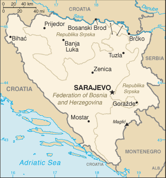
Map of Bosnia and Herzegovina
|
-
-
-
-
-
-
-
-
-
|
|
-
-
-
-
|
|
|
|
|